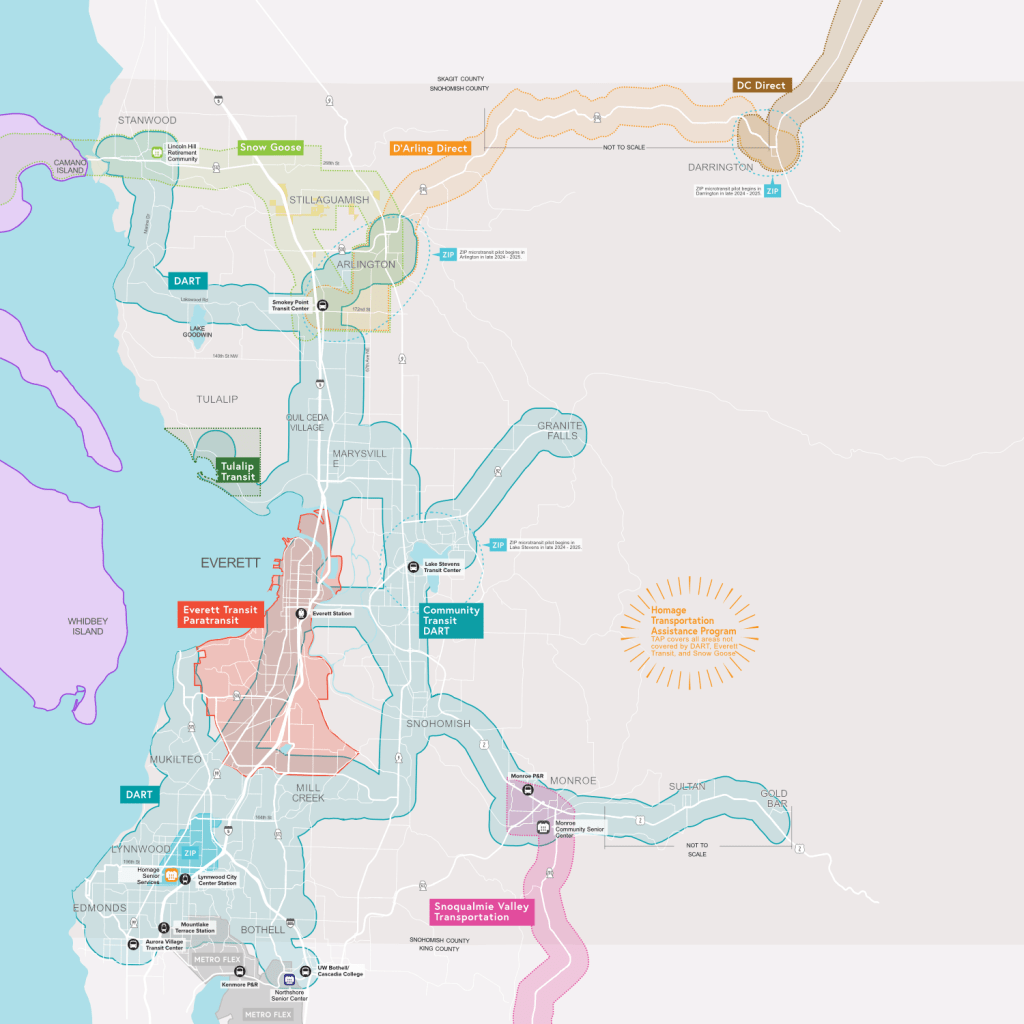
Door-to-Door Transit Services in Snohomish County
Map illustrates Everett Transit’s Paratransit, Community Transit’s DART, Homage Senior Service’s Transportation Assistance Program (TAP), Lincoln Hill’s Snow Goose Transit, Homage’s D’Arling Direct, Sauk-Suiattle Tribe’s DC Direct, Snoqualmie Valley Transportation’s Monroe-Duvall Shuttle, and existing and future microtransit services. Produced for vertical display at Lynnwood City Center Light Rail Station Grand Opening on August 30, 2024; earlier versions used in print and online publications.
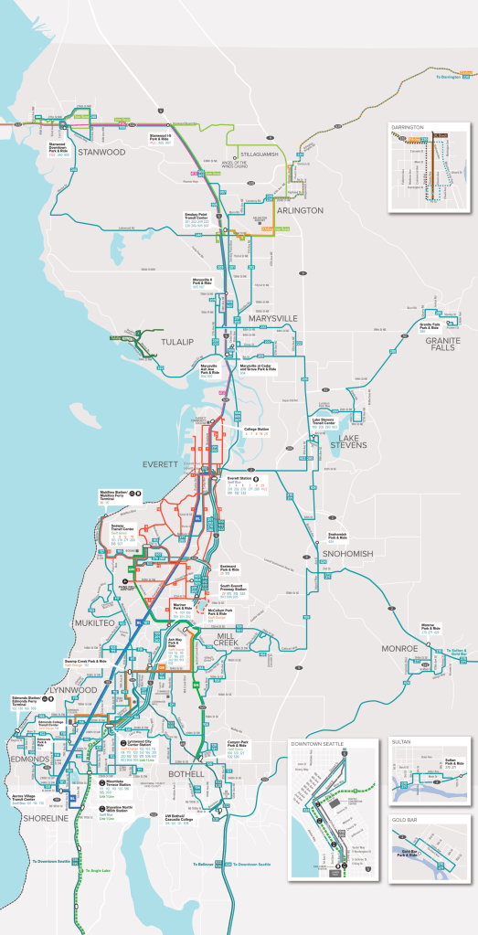
Fixed-Route Transit Services in Snohomish County
Map illustrates fixed- and flex-route transit services provided by Everett Transit, Community Transit, Sound Transit, Snow Goose Transit, Homage Senior Services, Snoqualmie Valley Transportation, and others. Map was adapted from Community Transit’s countywide fixed route map; produced for vertical banner display at the Lynnwood City Center Light Rail Station Grand Opening Celebration on August 30, 2024.
North Snohomish County Transit Map
Map illustrates fixed- and flex-route transit services in North Snohomish County, specifically for people who live in Stanwood and Darrington. Connections to Arlington and Mount Vernon are shown. Map was used the overview map in the North Snohomish County Transit Guide, and each individual transit service also received a focused map within the guide. Published in May 2024.

North Snohomish County Subway Map
For the North Snohomish County Transit Guide, created this simplified subway-style map to clearly illustrate the main services in the guide. Published in May 2024.
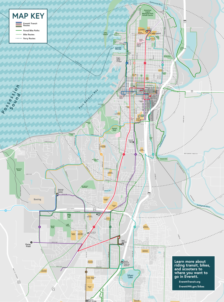
Everett Wayfinding Map
Map illustrates bikeways and Everett Transit routes throughout city, with concentric rings drown from Everett Station to show walking distance. Produced for a side panel on a telephone booth that was converted into a wayfinding kiosk and Little Free Library. Created in June 2024.

Everett Station / Downtown Map
Map provides street names and key destinations throughout the Everett Station District and Downtown Everett area. Produced for a side panel on a telephone booth that was converted into a wayfinding kiosk and Little Free Library. Created in June 2024.
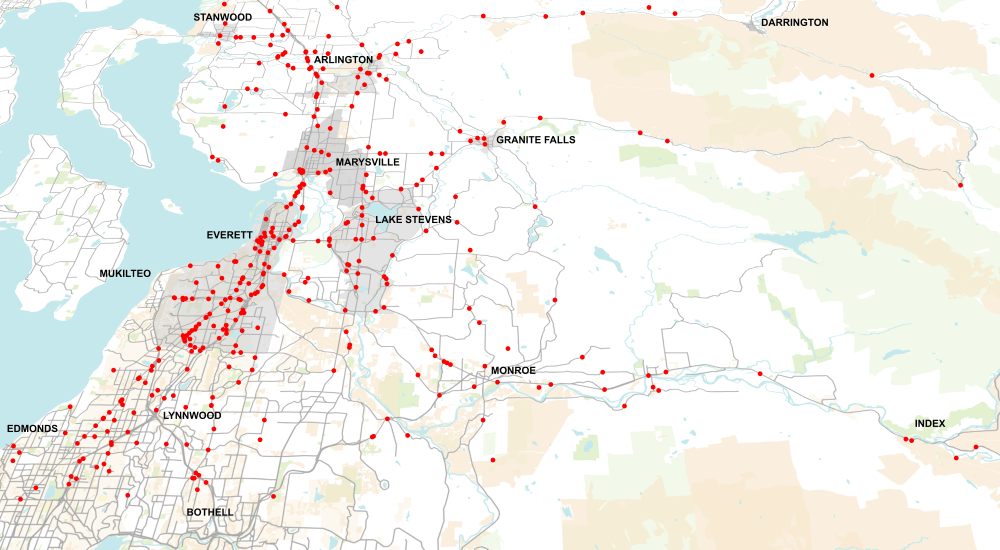
Snohomish County Traffic Fatalities
Map shows all traffic fatalities within Snohomish County over a 10-year period. Published in November 2022 as part of a press conference for the annual World Day of Remembrance for Road Traffic Victims.
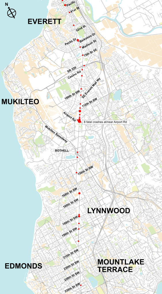
SR99 Traffic Fatalities
Map shows all traffic fatalities along SR99 within Snohomish County over a 10-year period. Published in November 2022 to draw attention to traffic safety concerns along the highway.
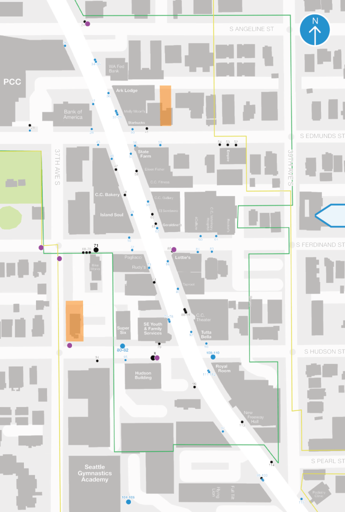
Columbia City Bike Parking Plan
Map created as part of bike parking proposal to install more than 100 bicycle racks throughout Seattle’s Columbia City neighborhood. Plan published and approved in 2018, implemented in 2020.
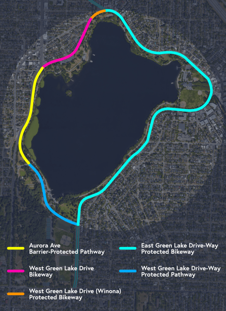
Green Lake Outer Loop Map
Map created for advocacy of completing the west side portions of the Green Lake Outer Loop Path.
